Looking for places to explore near you? Whether you're looking for a park to spend the day or one to stay for a week, we can help. Our goal is to help you find places to explore and experience, all while providing a simple itinerary based on our own experience.
2 of 4 excursions begin at the Chimney Top Rock Trailhead, located at the end of Chimney Top Rock Road at coordinates 37.8248° N, 83.6181° W. This site features a very large paved parking lot capable of accommodating at least 20 vehicles.
ParkingFor bathroom facilities, a public vault toilet is available directly within the parking area, though you should note that there is no running water on-site.
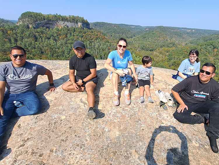
RestroomsThe journey to the Chimney Top Rock overlook at coordinates 37.8226° N, 83.6232° W follows the Chimney Top Trail #235, which is a short and easy 0.25-mile paved pathway. Starting from the parking area, this accessible trail passes directly through a scenic pine-hardwood forest before culminating at a massive sandstone outcrop. At the end of the paved path, you will be rewarded with jaw-dropping, 400-foot panoramic views overlooking a wide sweep of wooded hills and the Red River flowing through the gorge below.
A Chimney TopThe trek to Princess Arch at coordinates 37.8274° N, 83.6197° W follows the Princess Arch Trail #233, an unpaved but easy 0.25-mile trail located on the opposite side of the same parking area. This trail extends out along a dry, wooded ridge lined with rhododendron and mixed pine-hardwood stands. The path forms a short lollipop loop that guides you directly to the slender, graceful 32-foot stone arch, where hikers can safely navigate both over the top and underneath the geological formation.
A Princess ArchThe journey to Half Moon Arch at coordinates 37.8211° N, 83.6142° W follows an unofficial, unmarked 0.6-mile out-and-back trail that begins by ascending a steep dirt embankment directly across from the roadside pull-off. Once you climb into the woods, the pathway widens out into a well-worn dirt track that rolls along a narrow, high-elevation sandstone ridge lined with thick rhododendron and pine trees. The trail passes through several primitive backcountry campsites before arriving at Half Moon Rock, where a short scramble reveals the hidden, 7-foot-high sandstone arch nestled right into the exposed cliffside.
A Half Moon ArchThe journey to Friendship Arch at coordinates 37.8146° N, 83.6032° W follows an unofficial, unmarked 1-mile to 1.2-mile out-and-back user trail that begins on the right side of the road across from the main vehicle pull-off. The path rolls out along a relatively level, forested ridge lined with thick rhododendron and mixed pine stands, occasionally becoming a bit overgrown. The trail tracks directly across the top sandstone layer of the arch before hitting an overlook; from there, a very steep, three-tiered scramble down a rocky cliff shelf drops you safely underneath the massive, smooth-walled formation where the arch and the adjacent Friendship Tube rock shelter are hidden.
A Friendship ArchYour excursion begins at the Grays Arch Recreation Area parking lot, located at 37.8081° N, 83.6575° W. This gravel facility offers free parking for about 20 vehicles, though it fills rapidly on weekends.
To Parking SpotDirectly at this parking area, you will find the designated public restrooms, which are accessible vault/pit toilets. These are the only restrooms available along your hiking route, so it is highly recommended to use them before hitting the trails.
To BathroomTo reach the spectacular natural sandstone span of Grays Arch (37.8170° N, 83.6580° W), your hike sets off due north directly from the parking area trailhead. You will walk the initial 0.25-mile section of the Grays Arch Trail (#205) until you hit the intersection with the Rough Trail (#221), where you will take a right turn. The trail path is well-marked and relatively level as it runs along the ridge, but it becomes challenging as it descends sharply into the gorge via two large sets of wooden staircases. At the bottom of the second staircase, a right turn guides you straight to the massive rock shelter overhang and base of the arch.
To Gray's ArchFrom the base of Gray's Arch, you will continue your trek toward the unmarked user-made path to Hanson's Point (37.8164° N, 83.6267° W). You will backtrack slightly to the main Rough Trail loop and head deep into a demanding, rustic section of the gorge that features a steep sequence of downhills and uphills. The route requires navigating a brief 10-foot rock scramble using tree roots for leverage before ascending back up to the top of the ridge line. Once you reach the top spine of the ridge past Rush Branch, you will spot a wide, unblazed spur trail on your left that breaks away from the main path and carries you past backcountry campsites out to the wide, panoramic rock ledge of the point.
To Hanson's PointAfter completing your hikes, you will return to your vehicle at the recreation lot to begin your drive to the historic Nada Tunnel (37.8173° N, 83.6809° W). You will exit the parking lot by turning left onto the gravel surface of Tunnel Ridge Road, following it back out to the paved blacktop of KY-15. Turn right onto KY-15 West towards Slade, then quickly transition north onto KY-77. This winding road will bring you directly to the entrance of the famous 900-foot-long, one-lane railway shortcut carved directly through solid limestone rock face.
To Nada TunelThis is our recommended parking spot. There are many other options, but this is the best spot to explore the top hiking trails.
To ParkingBathrooms and ticket purchases for the Skylift are in the same place. We recommend using restrooms before starting activities, specially if you have kids.
To SkyliftOnce you get to the top of the Skylift, either ask how to get to Lookout Point, or simple go to your right, right under the Skylift and follow the trail all the way up to the Lookout Point.
To LookoutTo get to the Natural Bridge, go back the same way you came and right under the Skylift. Follow the trail all the way to the Natural Bridge.
To BridgeTo get to Fat Man's Missery, follow the trail without going back to the Natural Bridge. You will see some stairs. Note that the Fat Man's Missery is a very narrow path between two rocks. Overweighted people will struggle to get through.
To Fat Man's MisseryTo get to Balanced Rock, follow the Sand Gap Trail biefly until you get to the Balanced Rock Trail - Shelltowee NRT #100 split, then turn left. Continue until you find the rock formation.
To Balanced RockThis is our recommended parking spot. There are many other options, but this is the best spot to explore the top hiking trails.
ParkingWe recommend using restrooms before starting activities, specially if you have kids.
RestroomsSky Bridge Arch is a striking natural sandstone arch in the Red River Gorge Geological Area, offering panoramic views of the surrounding forested canyon and allowing visitors to walk both beneath and across the top of the formation.
To ArcoBuzzard’s Roost is a scenic overlook near the Sky Bridge Picnic Area in Red River Gorge, offering breathtaking views of the Red River valley, rugged sandstone cliffs, and some of the area's most spectacular sunset vistas.
To Buzzard's RoostSwift Creek Overlook is a picturesque viewpoint in Red River Gorge that provides sweeping views of the surrounding forested hills, sandstone cliffs, and the winding Swift Creek valley below.
To OverlookWhistling Arch is a unique natural sandstone arch in Red River Gorge known for the distinctive whistling sound that can occur when wind passes through its opening, creating an interesting geological and acoustic feature.
To Whistling ArchEagle’s Nest is a dramatic cliffside overlook in Red River Gorge that rewards hikers with breathtaking panoramic views of the Red River, surrounding sandstone ridges, and the rugged wilderness of the Daniel Boone National Forest.
To Eagle's Nest